Geo Routes
Discover the geological routes that compose the Basque Coast UNESCO Global Geopark. Enjoy nature and the landscape and get to know the natural and cultural heritage offered by the three municipalities that make up Geoparkea.
Download them on your phone and take them with you!
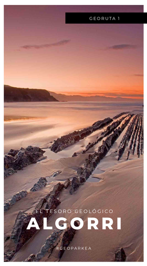
1. Algorri: the geological treasure
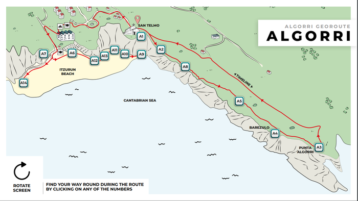
Download Algorri geo route (PDF 24,3 KB)
The Flysch of the Basque Coast Geopark is a book about geology gathering together over 50 million years of history, layer by layer, page by page. It offers such valuable information that experts have declared it to be a world geo-scientific landmark. The Algorri trail starts from the San Telmo chapel and covers the most exciting chapter of the Flysch: the Palaeocene. We will be walking along it like detectives of the past, discovering exciting episodes, such as the extinction of the dinosaurs or the various climate changes that have been recorded in geological history. Every step we take will transport us back in time and will enable us to get to know some of the key events in the history of our planet.
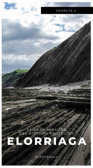
2. Elorriaga: the great viewpoint of the flysch
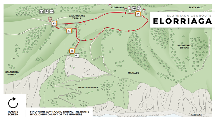
Length: 2 Km / Time: 45 minutes
Download Elorriaga geo route (PDF 7,5 KB)
The circular route of Elorriaga passes through the landscape of the Protected Natural Landscape countryside and approaches one of the broadest, most spectacular vantage points along the whole coast: the Elorriaga view point. There, open fields fall away all of a sudden and below our feet open out cliffs over a hundred metres high offering an excellent view over the great tidal platform, the Aitxuri inlet and the huge Pikote landslides. The keys for understanding the active dynamics of the cliffs and the complexity of the coastal ecosystems of the Protected Natural Landscape are revealed against this background.
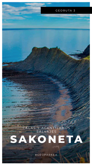
3. Sakoneta: along the coves and cliffs
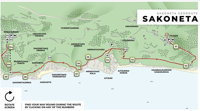
Length: 4.7 km / Time: 2 hours 15 minutes
Download Sakoneta geo route (PDF 16,9 KB)
This route takes us to the most concealed, eye-catching part of the Protected Natural Landscape: the Sakoneta and Mendata area. The trail proceeds along the very edge of the cliffs and leans out over quiet coves, walls of white rock, streams ending in waterfalls and one of the biggest tidal platforms of the Bay of Biscay. On this huge rocky platform, which crops out at low tide, the power of the sea has sculpted a geomorphological jewel, a dream-like landscape that also helps us to gain a better insight into understanding the natural heritage of the Protected Natural Landscape.
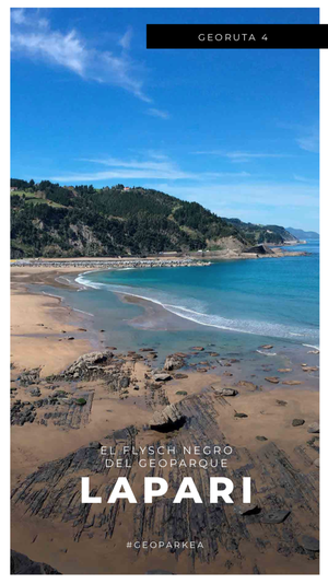
4. Lapari: the black Flysch
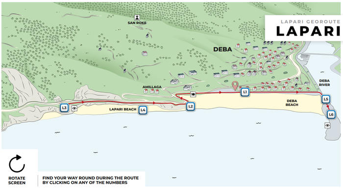
Length: 2 km / Time: 45 minutes
Download Lapari geo route (PDF 13,7 KB)
This short, straightforward route departs from the promenade in Deba, beside the beaches, and takes us all the way to the oldest rocks in the biotope: the black Flysch. The formation is less well known than that of Zumaia but offers some very striking points, such as the great folds of Aitzandi or the nodules and septaria of Deba. The route also takes us into the coral landscape of the Lower Cretaceous and provides the geological record of the biotope with an exceptional range.
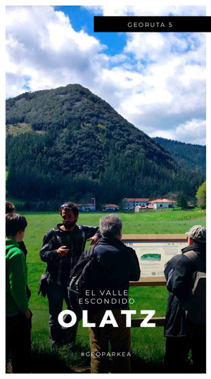
5. Olatz: the hidden valley
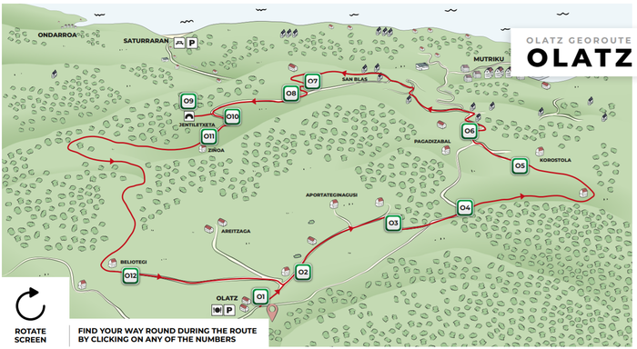
Length: 2 km / Time: 45 minutes
Download Olatz geo route (PDF 13,7 KB)
The Olatz Valley is a great depression surrounded by pyramid-shaped mountains. It is a depression formed by the dissolution of limestone that has completely conditioned the existence of large oak groves, prehistoric settlements and more recently, the locations and traditions of the valley hamlets. Enjoy a walk through this green landscape of holm oak, farmhouses and limestone.
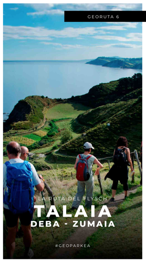
6. Talaia: the whole Protected Natural Landscape
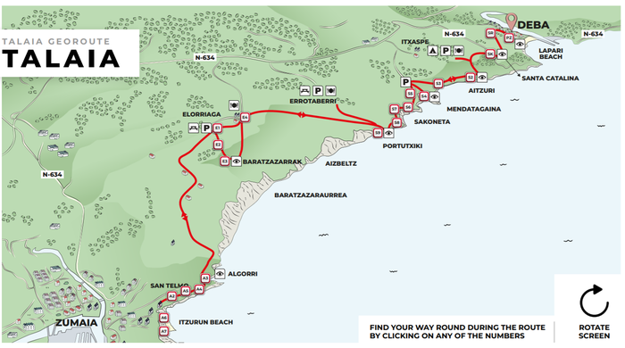
Length: 14 km / Time: 4 hours
Download Talaia geo route (PDF 13,9 KB)
The Talaia trail covers the whole of the coast of Gipuzkoa, from Hondarribia to Saturrarán, and the Protected Natural Landscape stretch is, without doubt, one of the most spectacular and interesting in the itinerary. This route brings together some of the most spectacular and most interesting points in the network of trails, while covering the coastline between Zumaia and Itxaspe along a perfectly signposted trail. Talaia is more arduous in physical terms, but it is the best way to get to know the scientific, scenic and natural assets of this protected area. The explanations of each point can be found in the corresponding themed trail.